Property Imagery
Aerial imagery with your purchaser's lot outlined, generated automatically from NSW Government backed data and built straight into the report.
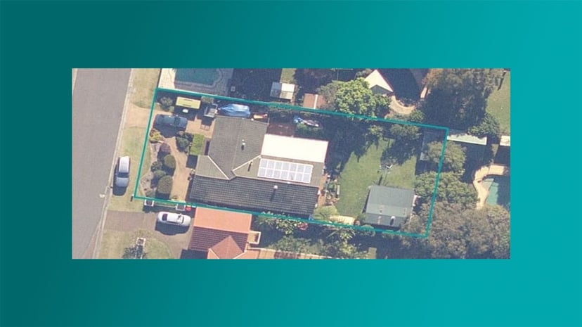
A purchaser wants to see where the property is and what the lot looks like on the ground. Done by hand it's a job in itself, find the address on a mapping site, screenshot the view, draw the boundary in PowerPoint, save it out, upload it back into the report. Most contract reviews skip aerial imagery for that reason. Curia Contract Review puts a real aerial view with the lot outlined into every file automatically, from NSW Government backed data, so your final report shows the purchaser what they're buying without the manual work.
The problem with mapping a property by hand
Most conveyancers don't include aerial imagery at all. Not because it wouldn't help the purchaser, but because doing it by hand isn't worth the time on every file. You'd switch to a mapping site, find the address, eyeball the parcel, screenshot it, mark up the boundary in whatever tool is at hand, save it out and upload it into the report. The result is approximate, varies file to file, and adds nothing to your fee. So most contract reviews go out without it, and the purchaser gets a less complete picture of what they're buying.
How Property Imagery works
Boundaries overlaid on the imagery
Lot boundaries are fetched from NSW Government backed data and overlaid on the aerial view. Your purchaser sees the satellite picture and the exact shape of the lot in one image, with no manual tracing.
Every title on its own, plus the whole property
For a contract with several titles, every lot gets its own image with its own boundary outlined. Curia also produces an aggregate image showing all the lots together, so the report covers each piece and the property as a whole.
Generated automatically, sourced officially
The image is built during contract processing, alongside the rest of the extraction work, from NSW Government backed data. There's nothing for you to fetch, render or upload. It's just there in the file when you start the review, and it's the same image that ends up in your purchaser's report.
Tuned to Australian conveyancing
Property Imagery is live for the NSW standard contract , drawn from NSW Government backed data and aware of the difference between deposited plans, strata plans and stratum lots. A standalone lot renders as a single outlined parcel, and a strata plan renders the full plan boundary the way it's officially recorded.
Where it sits in the review
The imagery appears inline on the contract review the moment processing finishes, so you can confirm at a glance that Curia has located the right parcel before you start working through the file. From there it flows straight into the final purchaser report , so the client gets a clean map of their lot without you opening a screenshot tool or uploading anything.
See Curia in action
See Curia handle a real contract. Book a demo .